Moab is a small desert town of about 5,200 people, bordered by two national parks, the Colorado River, and a million acres of public land. It’s compact but packed: within 30 minutes of Main Street you can be on a world-class mountain bike trail, a river rapid, or under a sandstone arch.
We’re so glad you’re here. We put this little guide together for guests of our new Airbnb because we’ve fallen in love with Moab — one of the rare, beautiful corners of this country — and we can’t wait for you to feel the same. Inside you’ll find our favorite activities, the meals worth showing up hungry for, and gentle tips that work for every age and every kind of traveler. More than anything, we hope you have the time of your lives out here. Please treat this fragile desert kindly and leave it clean for the guests who come after you, look out for one another, and soak up every minute. Welcome — make yourself at home.
This guide is organized by trip type — families, adventurers, photographers, and more — followed by the practical basics everyone needs: weather, food, and getting around. Find your group, then check the practicals before you go.
Quick orientation
Where: Southeast Utah — about 4 hours from Salt Lake City, 5.5 from Denver, 6 from Las Vegas.
Two national parks:
Arches NP — 5 miles north of town, dense with the famous arches, doable in a day.
Canyonlands NP — three districts: Island in the Sky (~40 min, the closest), Needles (~90 min south), and the Maze (a multi-day backcountry trip).
Plus: Dead Horse Point State Park, the Colorado River, the La Sal Mountains (over 10,000 ft, snow-capped into June), and public land in every direction.
Town layout: One main street (US-191). Nearly every hotel, restaurant, and gear shop is on it or a block away.
When to go
Season
Pros
Cons
Mar–May
Wildflowers, 60–80°F, rivers running high
Crowds peak in April
Jun–Aug
Long days, river/water activities shine
95–105°F; hiking dangerous after 10am
Sep–Oct
Best overall — 70–85°F, fewer crowds, fall colors in La Sals
Weekends still busy
Nov–Feb
Quiet, cheap lodging, snow-dusted red rock is unreal
Short days, cold nights, some outfitters closed
Sweet spots
Mid-October and mid-March. Avoid Easter weekend, Jeep Safari week (the week before Easter), and Memorial Day.
Reservations
Arches requires timed entry ~April–October, 7am–4pm. Book at recreation.gov ahead, or enter before 7am / after 4pm without one.
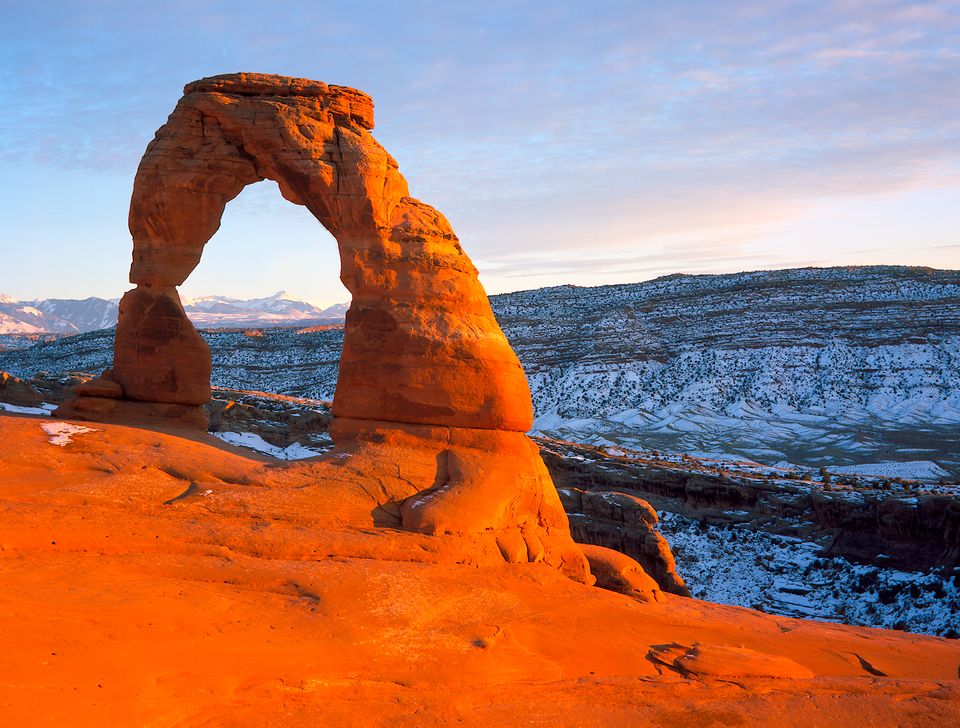
Delicate ArchBalanced Rock
02
Itineraries by traveler type
The adventure seeker
For visitors who want technical trails, real exposure, and a full day of effort.
Three-day plan
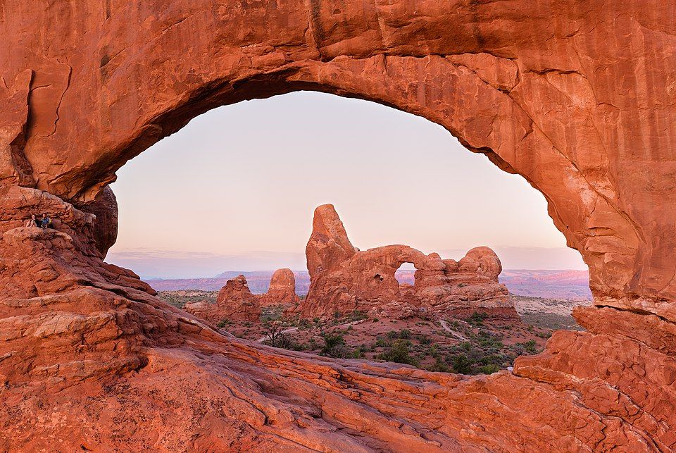
Day 1 — Slickrock + sunset: Half day on the Slickrock Bike Trail (technical and exposed; rent a full-suspension bike from Poison Spider or Chile Pepper). Sunset at Delicate Arch (3 mi round trip; the last half-mile is exposed slickrock).
Day 2 — Canyoneering or climbing: Guided canyoneering in Morning Glory or Medieval Chamber (rappels into slot canyons; try Cliffhanger Guides or Desert Highlights), or trad climb at Wall Street along the Colorado.
Day 3 — White water: A half-day Fisher Towers / Professor Valley run (Class II–III, with Mild to Wild, Western River, or Adrift Adventures) gets you the rapids without an overnight. For more, Cataract Canyon is a multi-day trip.
Going bigger: The Whole Enchilada (26-mile shuttle MTB descent from the La Sals to the river) and the White Rim Trail (100-mile bike or 4WD loop in Canyonlands, 2–4 days, permit required).
Gear shops: Gearheads (huge; 24-hour water refill outside) and Pagan Mountaineering (climbing-focused).
The family with kids
Short trails, big payoffs, and activities that work across a range of ages.
Three-day plan
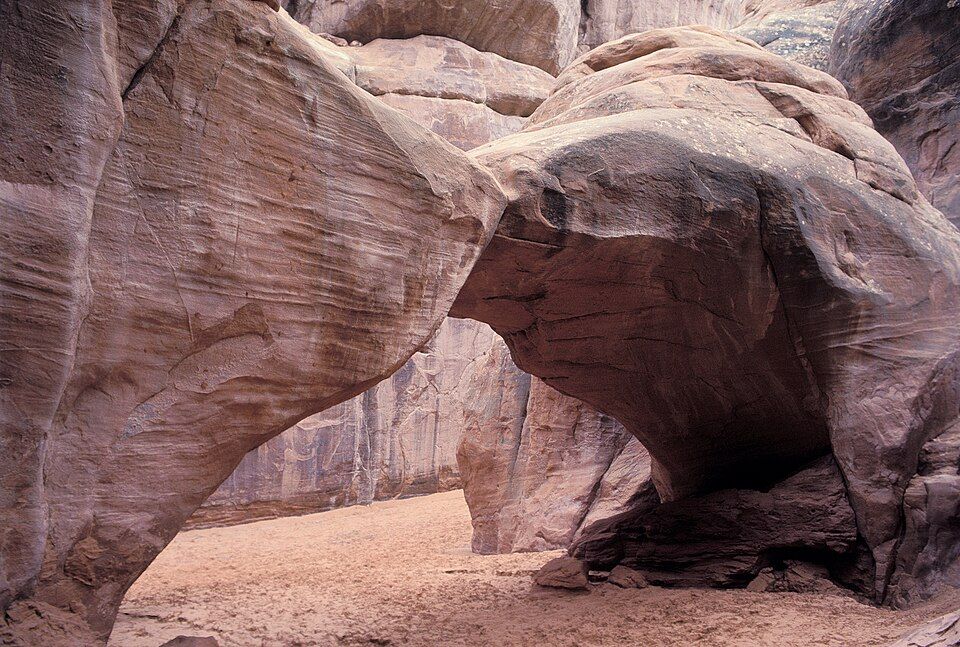
Day 1 — Arches highlights:Windows Loop (1 mi, flat-ish, three arches you can walk through) and Sand Dune Arch (0.3 mi, with a soft sand pit kids love). Skip Delicate Arch unless your kids are strong hikers.
Day 2 — Water day: Calm-water float on the Colorado (half-day, ages 5+, with Canyonlands by Night or similar). Afternoon at the Moab Recreation and Aquatic Center (indoor pool with a slide, $7).
Day 3 — Dinosaurs and dirt:Mill Canyon Dinosaur Tracksite (free, boardwalk, real tracks) and Moab Giants ($$, animatronic dinos, museum, splash pad). Sunset at Dead Horse Point — paved overlook, no hiking.
Kid favorites
Junior Ranger programs at both parks (free badges, about an hour each)
A guided Hummer or UTV tour — kids enjoy the ride, parents skip the driving
Ice cream at Moab Garage Co or shaved ice at Quesadilla Mobilla
Practical
A stroller works only on paved overlooks. Most park trails are sand or rock — bring a kid carrier (Osprey Poco) for under-4s.
The senior or accessibility-focused traveler
Big views with minimal walking, paved overlooks, and comfortable lodging.
Best low-effort viewpoints
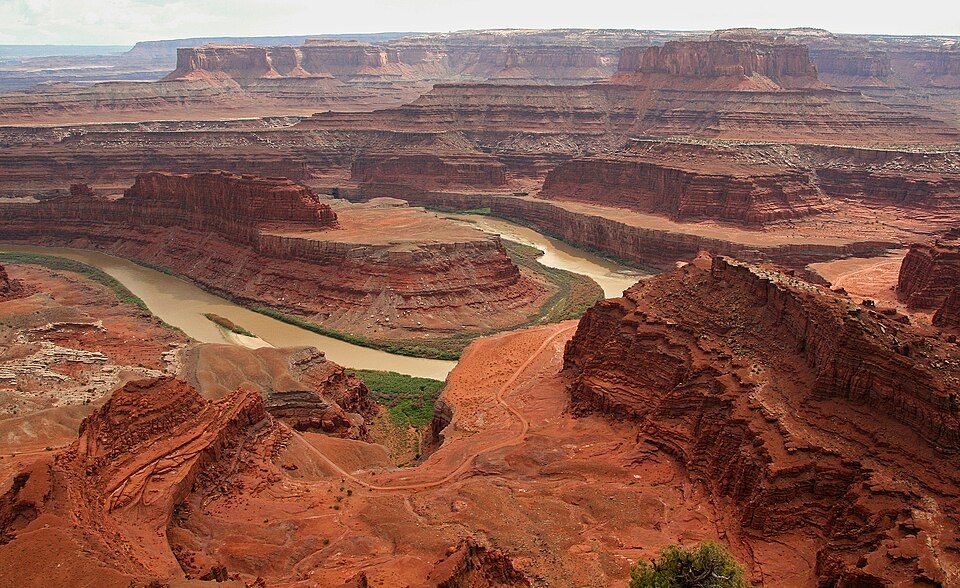
Dead Horse Point — paved overlook with an accessible restroom; arguably better than the Grand Canyon
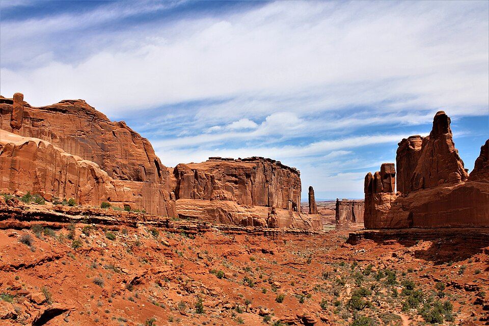
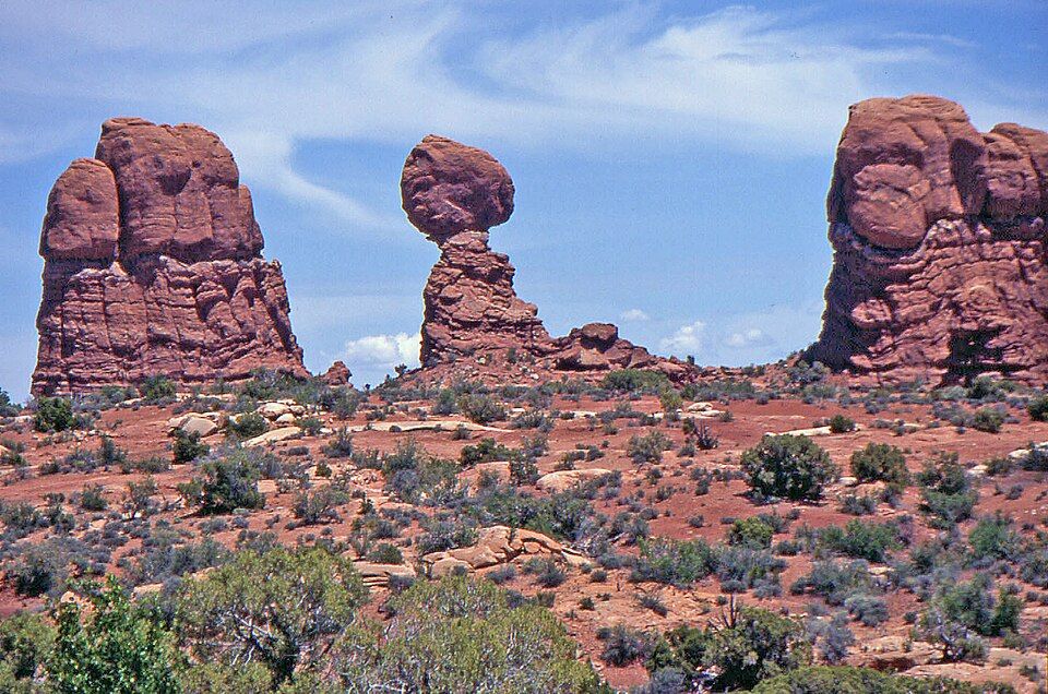
Arches scenic drive — the road is the show; pull-outs at Park Avenue, Balanced Rock, and the Windows are mostly flat
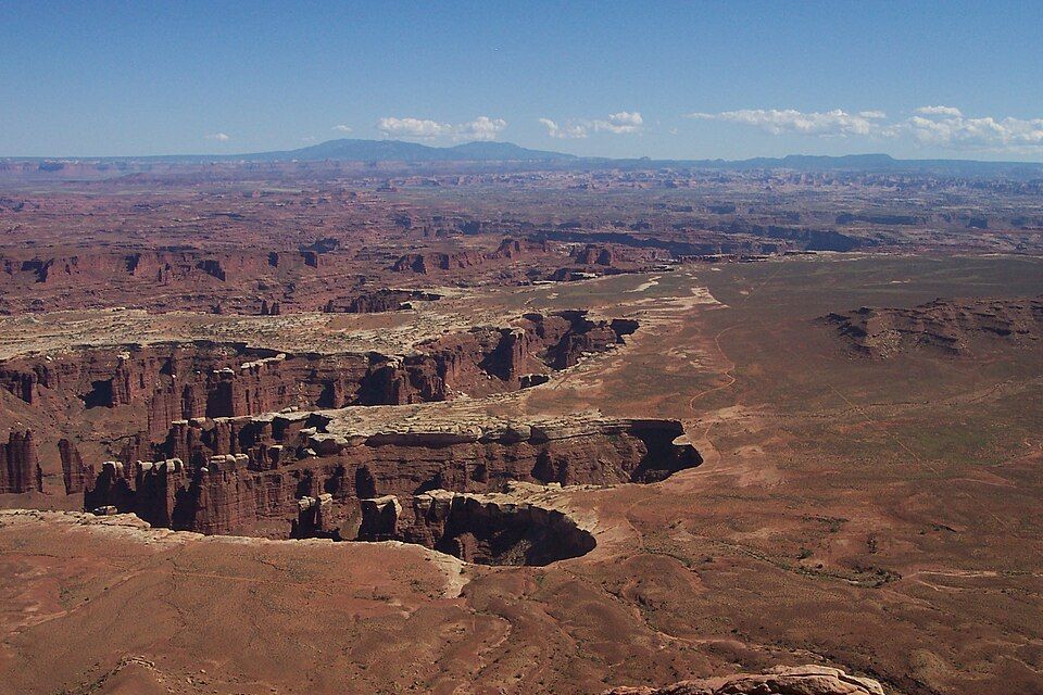
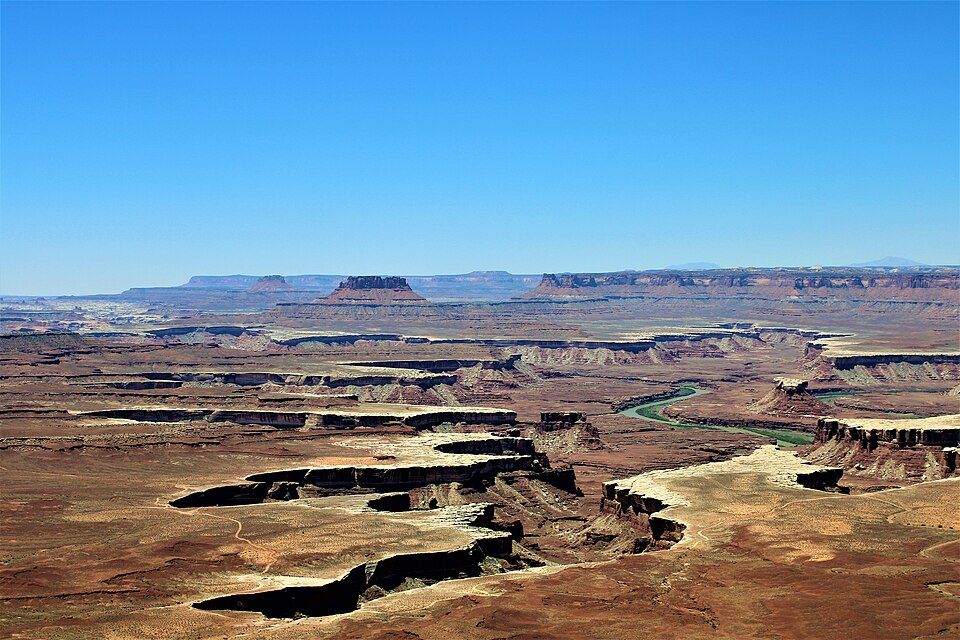
Canyonlands Island in the Sky — Grand View Point and Green River Overlook are short, mostly level walks
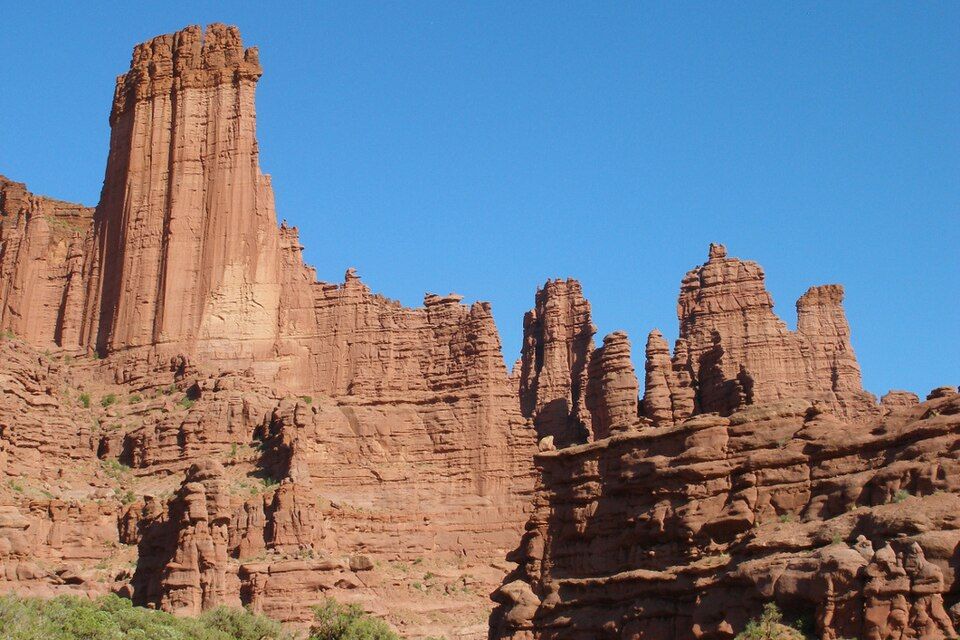
Fisher Towers at sunset — drive UT-128 along the Colorado; the cottonwood-lined river road is the prettiest paved drive in the state
Easy trails (under 1 mile, mostly flat)
Park Avenue overlook (Arches, paved)
Mesa Arch (Canyonlands, 0.5 mi loop, some uneven rock)
Balanced Rock loop (Arches, 0.3 mi, paved)
Comfortable activities
Canyonlands by Night — sunset jet boat with a sound-and-light show on the cliffs
Hot-air balloon at sunrise (Moab Balloon Adventures)
Scenic flight over both parks (Redtail Aviation, ~1 hour)
Lodging: SpringHill Suites or Hyatt Place — newer, with elevators and walk-in showers on request. Avoid older “lodge” properties with stairs.
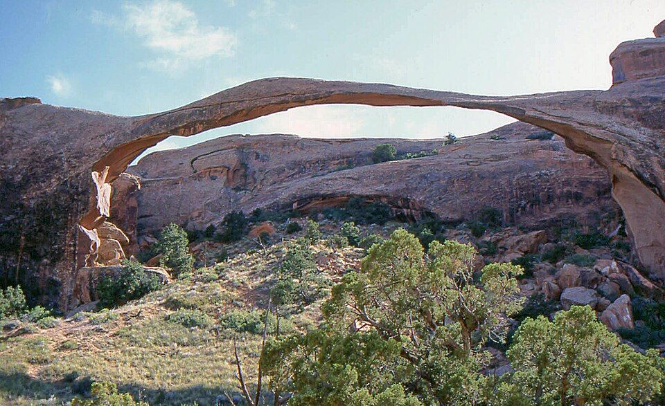
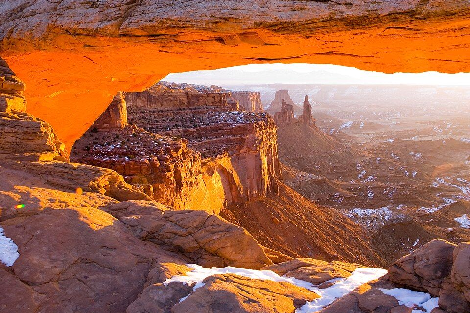
Mesa ArchLandscape Arch
The budget traveler
How to see Moab on about $80 a day instead of $800.
Sleep
Free dispersed camping on BLM land along Willow Springs Rd, Kane Creek Rd, or Hwy 313 (no facilities; pack out everything, including human waste — bag required)
Sand Flats Recreation Area — $15/night, first-come, near the Slickrock trail
Lazy Lizard Hostel — dorm beds ~$20, cabins ~$50
Goose Island Campground — BLM, on the river, $20
Eat
City Market deli sandwiches and hot bar (where locals go)
Quesadilla Mobilla food truck — $$ but huge portions
Milt’s Stop & Eat — classic burger joint
Cook your own — every campground has a fire ring; groceries at City Market
Free or near-free activities
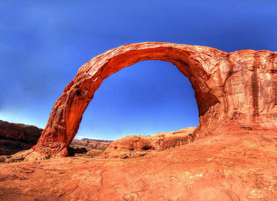
Corona Arch — bigger than most arches in the park, on free BLM land, 3 mi RT
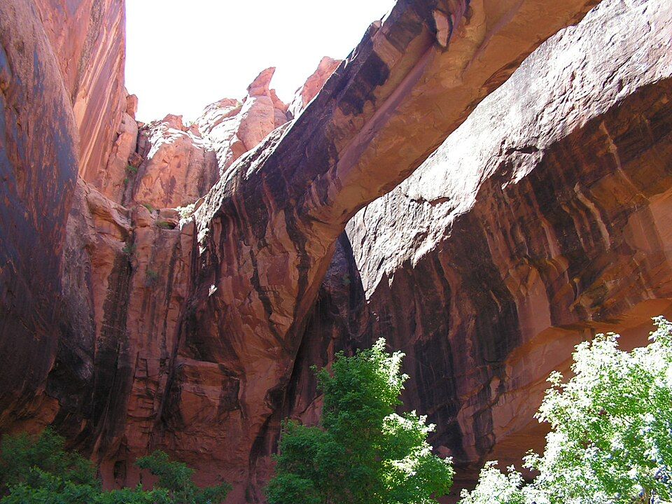
Grandstaff Canyon — creek hike to Morning Glory Bridge, 5 mi RT, free
Fisher Towers — 4 mi RT, free, surreal towers
Potash Road petroglyphs — pull off the road and look up
Park entry: $30/vehicle for 7 days, or the $80 America the Beautiful annual pass (pays off across 3 parks)
Skip: Hummer tours, jet boats, and helicopter rides — all $100–300 per person.
The luxury traveler
Resorts, private guides, and the best tables in town.
Stay
Sorrel River Ranch — riverfront resort 17 miles up UT-128; spa, stables, dark skies. The splurge.
Red Cliffs Lodge — also on UT-128, more rustic-luxe, with an on-site winery
Hoodoo Moab (Curio Collection) — newest in-town option, rooftop pool with red-rock views
Under Canvas Moab — glamping with king beds and en-suite baths in safari tents
Private guides
Custom 4x4 tour with Navtec or Tag-A-Long in a private vehicle
Helicopter tour with Redtail Aviation — land in the Canyonlands backcountry
Private chef and sunset dinner at a remote viewpoint (via Sorrel River concierge)
Photography workshop with a local pro (Tom Till Gallery can connect you)
Eat
Desert Bistro — fine dining, game and southwestern; reserve weeks ahead
River Grill at Sorrel River — riverside, white tablecloth
98 Center — small plates, the most ambitious kitchen in town
Sunset Grill — old uranium baron’s mansion on the cliff; the view is the point
The photographer
Where to be at sunrise, sunset, and after dark.
Sunrise
Mesa Arch (Canyonlands) — the iconic underglow shot. Arrive 45 min early; expect a crowd of tripods.
Delicate Arch — eastern light hits the arch face after sunrise; less crowded than sunset
False Kiva — closed indefinitely; do not attempt
Sunset
Delicate Arch — the postcard; 1.5-hour hike each way, headlamp for the return
Dead Horse Point — the Colorado River gooseneck glows
Fisher Towers — towers turn molten red in the last 15 minutes
Grand View Point (Canyonlands) — wide, big-sky setup
Night sky: Both parks are International Dark Sky Parks; new moon is best. Park Avenue, Balanced Rock, and the Windows are easy night setups. Green River Overlook is darker but a longer drive.
Logistics: Timed entry doesn’t apply before 7am or after 4pm — ideal for golden hour. Bring a polarizer (cuts haze, saturates the rock), a wide lens for arches, and a 70–200 for the towers.
The couple / romantic getaway
Scenic, low-stress days with good food and quiet evenings.
Three-day plan
Day 1 — Arrive and unwind: Sunset at Dead Horse Point (skip the Arches crowds). Dinner at 98 Center or Desert Bistro.
Day 2 — Hike and soak: Sunrise at Mesa Arch with coffee in a thermos. Midday on the Hidden Valley trail (quiet, big views). Afternoon couples massage at Moab Bathhouse or your hotel. Dinner on UT-128 along the river.
Day 3 — Float or fly: Half-day raft on the Colorado (calm water, pack a picnic) or a sunrise hot-air balloon. Drive home via the La Sal Loop Road (paved, 60 miles of alpine forest and aspen — an underrated drive).
Romantic dinner spots
Sunset Grill — cliffside, sunset over the valley
Sorrel River Ranch — if you splurge, do it here
River Grill at Red Cliffs
Quiet stays: Sorrel River Ranch (best), Cali Cochitta B&B (in-town Victorian), and Moab Springs Ranch (condos with private hot tubs).
The pet owner
The national parks are strict with dogs — leashed only on paved roads and developed campgrounds, never on trails. The surrounding BLM land is far more dog-friendly.
Dog-friendly trails (off-park)
Mill Creek Pathway — paved, in town, water access
Grandstaff Canyon — creek the whole way, leashed, BLM land
Hunter Canyon — quiet, water, leashed
La Sal Mountain trails — cooler in summer, off-leash in National Forest
Dog-friendly stays: Most Moab hotels are dog-friendly with a fee (Hyatt Place, Element, Best Western Greenwell). Camping at BLM dispersed sites is free and dog-friendly.
Daycare: Karen’s Canine Campground does day boarding so you can do the parks dog-free. Book ahead.
Heat warning
Pavement and slickrock hit 140°F+ in summer. Test with the back of your hand for 7 seconds. If you can’t, your dog can’t.
Fisher TowersThe La Sals
03
Hikes At a Glance
Every hike mentioned in this guide, in one place, with a photo and the basics. Distances are round-trip unless noted.
A canyon of vertical fins like a Manhattan skyline. The overlook at the top is paved and accessible; the trail down through it is a one-way 1-mile walk to a second pull-out (need a shuttle car).
1.6 mi to Landscape Arch, up to 7.2 mi for full loop · Easy to strenuous
Landscape Arch is the longest natural stone arch in North America (306 ft) and an easy, mostly flat walk. Continuing past it gets technical: narrow fins, exposure, scrambling. The full primitive loop is the best long hike in Arches.
The sunrise underglow shot every photographer wants. Arrive 45+ min before sunrise to claim a spot. Easy walk; the arch is on a cliff edge — mind kids.
The big payoff view of the Colorado River basin 2,000 ft below. The first overlook is paved; the trail continues along the rim to a more dramatic point.
Surreal red-rock towers that turn molten at golden hour. Some exposure, one ladder section. Drive up UT-128 along the Colorado to reach the trailhead — the road itself is worth it.
The best view in southeast Utah for the lowest effort. Paved overlook plus an optional 5-mile rim trail. Sunset and sunrise both deliver.
04
Hike Logistics
Getting there
Drive: Most visitors arrive via I-70, exit 182 (Crescent Junction), then 30 miles south on US-191.
Fly: Canyonlands Field (CNY), 18 miles north — limited service from Denver (United/SkyWest). Grand Junction (GJT), 110 miles east, has more options. Salt Lake City (SLC) is the cheapest, 4-hour drive.
No Uber/Lyft to count on. Rent a car.
Canyon CountrySunrise Balloon
Flying in: routes from home
There’s no major airport in Moab itself, so almost everyone flies into a gateway city and drives the rest of the way — a scenic finish through red-rock country. Rent a car at whichever airport you land in (you’ll want it here anyway); a regular car is fine for the house, town, and paved park roads. Here’s how the airports stack up, with drive time to the front door in Spanish Valley:
Airport
Distance
Drive to the house
Notes
Canyonlands Field (CNY)
18 mi
~35 min
Moab’s own airport; few flights (Denver connections), higher fares
Grand Junction (GJT)
110 mi
~2 hrs
Closest full airport; the shortest drive of the “real” options
Salt Lake City (SLC)
235 mi
~4 hrs
Biggest hub, most nonstops, cheapest fares, largest rental fleet
Denver (DEN)
355 mi
~5.5 hrs
Big hub; long but easy drive on I-70
Las Vegas (LAS)
455 mi
~6.5 hrs
Only worth it for a Vegas/Zion road-trip loop
From the Bay Area (SFO)
Easiest — fly to Salt Lake City. SFO→SLC is a quick nonstop (~2 hrs, many daily), typically on United or Delta, then a ~4-hour drive down. The simplest, best-value option and the biggest rental selection.
Shortest drive — fly to Grand Junction. SFO→GJT is usually one stop (United via Denver, or Delta/United via Salt Lake); from there it’s only ~2 hours to the house.
Closest to the door — fly to Canyonlands (CNY). Connect through Denver on United Express (SkyWest) and you land 35 minutes away, but flights are limited and pricier.
From Los Angeles (LAX)
Easiest — fly to Salt Lake City. LAX→SLC is a frequent nonstop (~1h45), typically on Delta, United, Southwest, or American, then the ~4-hour drive. The most reliable choice.
Shortest drive — fly to Grand Junction. LAX→GJT with one connection (usually via Denver or Salt Lake) puts you ~2 hours out.
Road-trip option — fly to Las Vegas. LAX→LAS nonstops are cheap and constant on Southwest, Delta, American, and Spirit; the ~6.5-hour drive is long but lets you fold in a Zion or Vegas stop.
From Austin (AUS)
Best balance — fly to Salt Lake City. AUS→SLC nonstops (~3 hrs) run on Southwest and Delta, landing you at the biggest hub, then ~4 hours up. Fewest headaches.
Also good — fly to Denver. AUS→DEN nonstops are plentiful (~2.5 hrs) on United, Southwest, and Frontier; it’s a longer ~5.5-hour drive but an easy, straight shot on I-70.
Shortest drive — connect to Grand Junction. AUS→GJT (usually via Denver on United) trims the drive to ~2 hours.
Stretching your points & miles
The good news for award travel: the gateways here are big hubs, so award seats into Salt Lake City and Denver are usually plentiful and easy to grab. Here’s how the major programs play for these routes.
By airline
Southwest (Rapid Rewards) — Strongest out of Austin and LAX. Points price dynamically off the cash fare, so they’re the best value when fares are low, with no blackout dates or change fees. There’s no first class, but the real prize is the Companion Pass: earn it (often via a card sign-up bonus) and a companion flies with you for just taxes all year — which pays off fast on repeat Moab trips.
United (MileagePlus) — The best all-arounder here. SFO and Denver are United hubs, and United Express (SkyWest) flies the regional legs into Grand Junction and Canyonlands (CNY) — so you can sometimes book a single award ticket almost to the door and skip the long drive. Use PlusPoints (Premier Platinum/1K) or miles-plus-copay for upgrades, and the Excursionist Perk to add a near-free segment on a multi-city award.
American (AAdvantage) — Best from LAX (a major AA hub) and workable from Austin via DFW. Watch for reduced-mileage web specials, and use miles-plus-copay or systemwide upgrades (with status) to move up front. Connect to Grand Junction via DFW or Phoenix.
Delta (SkyMiles) — Salt Lake City is a major Delta hub, so it’s the natural pick for the SLC nonstops from all three cities. Fully dynamic pricing (no award chart), but flash sales are frequent; upgrade with miles or Medallion status.
Tips to get the most out of them
Book the gateway on points, drive the rest. Award seats into SLC and DEN are usually wide open — spend the miles when cash fares spike, then make the scenic drive.
Fly miles all the way to GJT or CNY. United/SkyWest serves both, so a single award can save you the ~4-hour Salt Lake drive when you’d rather not.
Chase a Companion Pass if you travel as a pair or family and expect to come back — it’s the single biggest points win for this trip.
Keep points transferable. Chase Ultimate Rewards → United or Southwest, Amex Membership Rewards → Delta, and Capital One/Citi → many partners let you book whichever airline is cheapest that week.
Upgrades are likeliest on the mainline legs (SLC, DEN, SFO, LAX). The regional hops into GJT/CNY are small jets — often single-class — so don’t count on a premium seat there.
Award pricing and program rules change constantly — check current award space and fares before you book.
Where to stay (overview)
In town: Walking distance to restaurants/shops. Hotel chains, B&Bs.
North on UT-191: Cheaper, closer to Arches, less character.
UT-128 (river road): Sorrel River, Red Cliffs, Castle Valley Inn — gorgeous, 15–30 min from town.
Camping: Devil’s Garden (Arches, reservations open 6 months out, books in minutes); BLM along the Colorado (Goose Island, Big Bend, Hal Canyon — reserve at recreation.gov); Sand Flats (first-come).
Food recommendations
Meal
Pick
Breakfast
Love Muffin Café (huevos, breakfast burritos)
Coffee
Moab Coffee Roasters
Lunch
Quesadilla Mobilla, Milt’s, City Market deli
Casual dinner
Moab Brewery, Pasta Jay’s, Zax
Nice dinner
Desert Bistro, 98 Center, Sunset Grill
Drinks
Proper Brewing, Spanish Valley Vineyards
Treat
Moab Garage Co. ice cream, Doughbird donuts
Utah liquor laws are quirky: most beer at restaurants is 5% ABV; cocktails and wine are available but pours are regulated. State liquor store closes early; plan ahead.
A closer look at the food
The short version is the table above; here’s the longer one. We’re in Spanish Valley, so almost everything is a quick hop north into town — drive times are from the house, ratings are our own, and both are just a starting point. Find your own favorites and tell us about them.
Fresh cake donuts and coffee. Go early — they sell out.
Prickly PearDesert Juniper
Essentials & errands
We’re about ten minutes south of Moab’s Main Street, where nearly everything you’ll need is clustered within a few blocks. One heads-up before you shop: there’s no Walmart or Target in Moab — the nearest big-box stores are in Grand Junction, Colorado, about two hours away. For a weeklong stay, City Market covers almost everything, and the local spots below fill in the rest.
Groceries
City Market (Kroger) — the full-size supermarket on S Main, ~9 min from the house. Groceries, deli, bakery, and an in-store pharmacy. Your one-stop for the week.
Village Market — a smaller neighborhood grocery, handy for a quick run when you don’t need the big store.
Pharmacy & health
City Market Pharmacy — inside the supermarket; prescriptions plus a full over-the-counter aisle.
Walker Drug — longtime local drugstore on Main with pharmacy, first-aid, and general goods.
Moab Regional Hospital — ER and urgent care on W Williams Way. It’s the only hospital for roughly 1.5 hours in any direction, so it’s good to know where it is.
Paper products & household
City Market — paper towels, toilet paper, cleaning supplies, diapers, and basics all in one place.
No Walmart or Target locally — for a big-box run, Grand Junction, CO is the nearest (~2 hrs). Plan a single City Market trip instead.
Gas & auto
Stations on Main Street (Maverik, Phillips 66, and others) — fill up in town. Heading into Canyonlands or south toward the Needles, the next gas can be 50+ miles away.
Moab Ace Hardware — camp fuel, coolers, batteries, and any forgotten gear or supplies.
Other useful stops
Gearheads — outdoor gear and a 24-hour water-refill station outside.
Laundromat — self-serve laundry on/near Main for longer stays.
US Post Office — just off Main Street for stamps and shipping.
Utah State Liquor Store — S Main; wine and spirits are sold here only (grocery/restaurant beer tops out at 5% ABV). It closes early, so plan ahead.
Moab Information Center — corner of Main & Center; maps, park permits, restrooms, and a water refill.
Health, safety, and the desert
Water: Bring more than you think. 1 gallon per person per day in summer is a floor, not a target. Refill stations at the Moab Information Center, Gearheads, and most trailheads.
Heat: Hike before 10am or after 5pm, May–September. Heatstroke is the #1 SAR call.
Flash floods: Slot canyons (Morning Glory, Sand Dune Arch area) flood from storms 30+ miles away. Check the Moab area weather forecast every morning, even if your sky is blue.
Altitude: Moab is 4,000 ft. La Sal trails go to 12,000 ft — pace yourself.
Cell service: Verizon is best. AT&T spotty. T-Mobile mostly nothing once you leave Main Street. Download offline maps (Gaia GPS, AllTrails Pro).
Gas: Fill up in Moab. Next station heading into Canyonlands or south toward the Needles is 50+ miles.
The Cryptobiotic crust: That black crusty soil isn’t dirt — it’s living. Don’t bust the crust. Stay on slickrock, sand washes, or established trails.
Day trips from Moab
Dead Horse Point State Park (40 min) — better view than Canyonlands’ Grand View, fee $20
Goblin Valley State Park (90 min) — surreal hoodoos, kid heaven
Needles District of Canyonlands (90 min) — the road less traveled
Capitol Reef NP (2.5 hrs) — orchards, petroglyphs, less crowded than Arches
We hope you had a great trip — good hikes, good meals, and a real feel for what makes this place special. Moab has a way of bringing people back, so we hope we’ll see you again.
If you enjoyed your stay, a review on our Airbnb listing means a lot and helps other travelers find us. And if anything fell short or could be better, tell us — it’s how we improve. Safe travels, and thanks for taking good care of the place.